Home » Our Business » Port Services »
Facilities
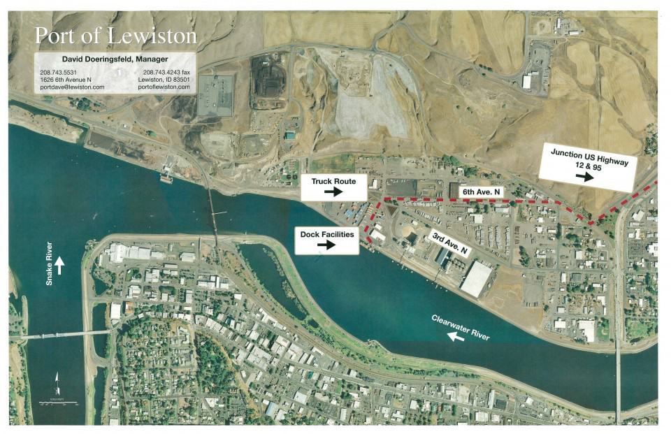
Location
- Longitude and latitude: 46.146N, 117.016W
- Navigable end of the Columbia-Snake River System, 465 river miles inland from Portland/Vancouver
- 745 feet above sea level
Crane
- 250-ton Manitowoc 4100 Series 2 Lift Crane
- 120-foot boom
- Picking limits – 193,000 lbs at 32-feet (max pick off a river barge), 140,000 lbs at 40-feet, 103,000 lbs at 50-feet, 81,000 lbs at 60-feet.
- Indoor Storage
- 20,000 sf Dockside warehouse for cross docking
- 150,000 sf secure, full service warehouse—Inland 465
Security
- Dockside security cameras and lighting
Personnel
- Certified crane operators
- Non-union
Navigation Channel
- 14 foot deep navigation channel
- 50 barging hours between Port of Portland/Vancouver and Port of Lewiston
- USACE link to Confluence Water Levels
Dock
Outdoor Storage
- Approximately 20 acres available adjacent to dock facilities
- Additional on-site mooring dolphins to service multiple barges
Highways
- The Port’s location next to US Highway 12 allows to direct link to markets in Montana.
- The Port’s proximity to US Highway 95 allows for links to Boise, Idaho, and US-84 to the South, and Spokane, Washington and US-90 to the North.
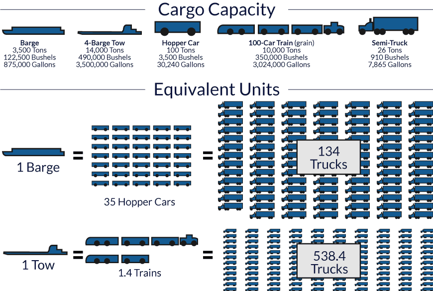
Barging is an efficient and inexpensive way to ship commodities. More commodities can be shipped on barges, requiring far less fuel than other modes of transportation, helping the shipper save on costs and substantially reducing the carbon footprint of product transportation.
For example, the US Army Corps of Engineers estimates shippers save approximately $36 million annually by barging instead of using other forms of transportation. One barge filled with commodities is roughly the equivalent to 35 hopper cars and 134 trucks.


